Tuesday, April 26, 2011

Funchal, Madeira, Portugal


Panorama of Port of Funchal

Tuesday, April 16, 2011      65 degrees                                                5:30 AM – 3:00 PM

In port at Madeira
       
We set out on a southwesterly course to Madeira.  The Madeira archipelago was discovered by the Portuguese in the 15th century.  At this time the islands were still uninhabited.  After its discovery, the islands have been mainly under Portuguese sovereignty.  All islands in the Madeira archipelago are of volcanic origin.  Because of this, Madeira is mountainous.  The tallest peak on Madeira is Ruivo de Santana.  The harbor of Funchal is mainly used as a passenger terminal for the tourist industry.

The marine approach presents a stunning picture as the colourful and majestic Madeiran peaks suddenly appear from the blue mist.  The island’s mystery begins in beauty, but the enigma is enhanced by suggestions that it may be the remains of the lost continent Atlantis.  Colourful flowers and spectacular waterfalls are the spawn of Madeira’s fertile soil and perfect climate – warmed by Atlantic currents in winter and cooled by trade winds in summer.  Everything seems to grow – and as if to prove the point, a hodgepodge of shrubs and flowers have been imported from all over the world.  It is not a big place – the island is only 35 miles long and 13 miles wide at its widest point, but roads climb and drop precipitously from one ravine to the next, so travel times are longer than expected.  Funchal is named for one of the most fragrant native plants – funcho (fennel).
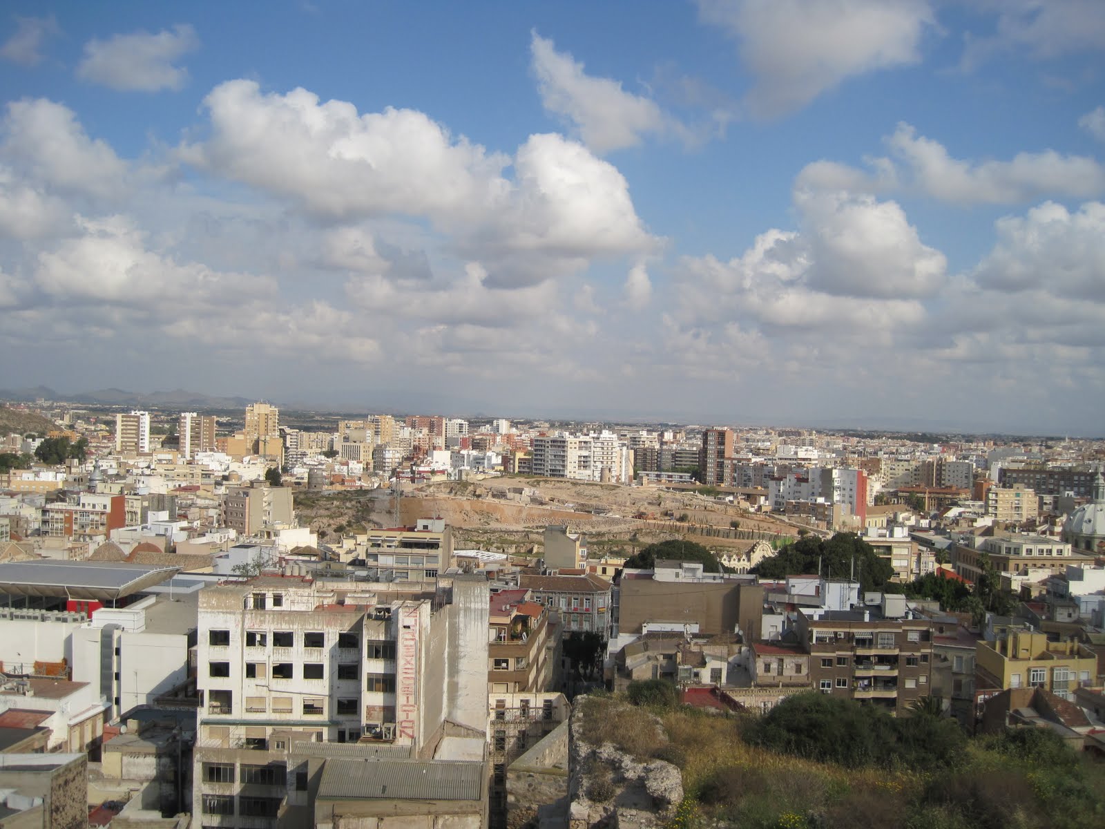
 Funchal is the capital of the Madeira Islands of Portugal and is also the largest city on the islands.  It was founded by Gonsalves Zarco in 1421 and was elevated to city by King Manuel I in 1508.  It was important as a stopping place between the Indies and the New World, and was known as a wealthy place.  Portugal, located in southwest Europe on the western Iberian Peninsula, includes the Madeira Islands and the Azores in the northern Atlantic Ocean.
 Funchal is graced with an unusually dramatic setting.  At its back, jagged mountains – some 1,200 metres high – encircle the city like a giant amphitheatre, while its feet are lapped by the sea.  The historic core of the capital still overlooks the harbor and boasts fine government buildings and stately 18th C houses with shady courtyards, iron balconies and carved black basalt doorways.  The town has steep cobbled streets and overall air of grandeur.
We toured Funchal on our own this morning.  We boarded the shuttle bus into town and then walked along the harbor to catch the cable car to take us up to Monte.  Opened in 2000, the two mile long Doppelmayr cable route takes approximately 10 minutes in each direction.  As we left the station, the old city comes into view.   As the car climbs above the city we were rewarded with sweeping views of Funchal harbor.   Just below the chuch in Monte we watched people getting in sleighs powered by 2 men which takes you ½ way down to Funchal.
Monte is only 4 miles from Funchal, but nearly 2,000 feet high, in the highest part of a national park, it seems more like heaven.  Austrian Emperor Carlos I is buried at Nossa Senhora do Monte, a hilltop chapel built on the site of the earlier Church of Encarnacao.  When you see the façade of this charming church you cannot resist climbing the 68 steps to see inside.
We took the cable car back down to return to Funchal.  The first place we visited was the famous covered market, the Mercado dos Lavradores.  Built in 1941 it has strong Art Deco overtones.  All the hustle and bustle of Funchalese life is here, spilling out from the arcaded inner courtyard with its dozens of stalls piled high with vegetables, herbs, flowers and exotic fruit. Head through the doors at the eastern end to find the fish market, a good place to make your acquaintance with Madeira’s famous black espada, the eel-like, razor-toothed scabbard fish that crops up on every restaurant menu.
We walked around the downtown area, browsing in the stores and then took the shuttle bus back to the ship a 1 PM.


View of church from cablecar
 
The sleighs of Monte


Watching sleighs from church above

Chris in downtown Funchal


Cadiz, Spain

93 miles southwest of Seville
Sunday, Apr. 17, 2011      65 degrees                          10:00 AM – 11:00 PM
We followed the coast of Spain towards the Strait of Gibraltar which we transited early this morning.  Due to the high amount of traffic transiting this entrance to the Mediterranean, a traffic scheme has been established to ensure all vessels can safely navigate the strait.  After clearing the traffic scheme we headed on a northerly direction towards Cadiz.
Cadiz is a coastal city in southwestern Spain in the region of Andalusia and the capital of the province of Cadiz.  Traditionally, its date of establishment is about 1100 BC, although as of 2004 no archeological finds have been found that date back further than the 9th century BC>  It is regarded as the most ancient extant city in western Europe.
CADIZ  Surrounded by the Atlantic Ocean on three sides, Cadiz was founded as Gadir by Phoenician traders in 1100 BC and claims to be the oldest continuously inhabited city in the Western world.  Hannibal lived in Cadiz for a time, Julius voyage, after which the city became the home base of the Spanish fleet.  Most of its buildings – including the cathedral, built in part with gold and silver from the New World – date from this period.  The old city is African in appearance and immensely intriguing—a cluster of narrow streets opening onto charming small squares.  The golden cupola of the cathedral looms above low white houses and the whole place has a slightly dilapidated air. 


We took a shore excursion “Stunning Seville”.  From Cadiz we had a 1-1/2 hour drive through Andalusia’s cork plantations to Spain’s 4th largest city, Seville.  It  is the capital of Andulusia, and has a Muslim heritage.  Seville’s whitewashed houses bright with bougainvillea, its ocher-coloured palaces, and its baroque facades have long enchanted both Sevillanos and travelers.  Seville oranges are too bitter to eat except as Scottish-made marmalade. 
Seville throws the most spectacular fiesta in all of Spain during Holy Week, between Palm Sunday and Easter, followed by the decidedly more secular Feria de Abril, starring horses and bullfights. 
Our coach let us off at the Spanish Square.  From there we walked to Pilot’s House, which is a normal family residence fashioned after the Alcazar.  It has Moorish, Italian and Renaissance influence (Roman sculptures).  It is known as Pilot’s House because Don Fadrique allegedly modeled it on Pontius Pilate’s house in Jerusalem where he had gone on a pilgrimage in 1518. 
We went to Pilot’s House instead of the Cathedral as this is Palm Sunday and there will be 60 processions passing through it in the next week.  In the parades the people have special costumes on that cover their faces – to have a private station of penetance.    They have to wear sandals or bare feet.  We went to the Macarena Hotel for a hot and cold buffet lunch.  We then visited the oldest area (the Jewish Quarter).  The twisting alleyways and traditional whitewashed houses add to the tourist charm of this barrio.   We were given ½ an hour to shop in the Santa Cruz quarter with its ceramic tiles and iron railings. 
We next visited the magnificent Alcazar – royal residence – a monument to the Moorish occupation of Spain surrounded by glorious gardens.  The palace is the official Seville residence of the king and queen when they are in town.  We visited the Hall of Justice, the Courtyard of Plaster, and the Court of the Damsels which opened off the Hall of the Ambassadors.  There were ducks in the pond in the garden and well as many, many Carp to keep the water clean. 
We drove the 1-1/2 hours back to the ship where we had a cultural presentation which showcased flamenco dancers.

Cartagena, Spain

Saturday, Apr. 16      67 degrees                                                           8:00 AM – 3:00 PM

Panoramic view of Cartagena

We set out on a southwesterly course towards Bonifacio Strait.  This strait lies between the French island of Corsica and the Italian island of Sardinia.  Both islands are very mountainous and rugged.  Corsica is the most mountainous island in the Mediterranean.  The town of Cartagena is surrounded by several forts, three of which should be visible on our approach standing on the hills surrounding Cartagena.  The forts are called respectively Castillo Atalya, Galeras and San Julian all of them named after the summit they stand on.
Cartagena has long been an important maritime base.  The fortifications are mostly gone, but the port area shows something of its naval history.  Renovated in the Middle Ages, Castillo de la Concepcion was originally a Roman structure.  Lush gardens surround the remains of the castle, and the view is excellent.  A broad seaside esplanade lines the flanking ramparts – built in the  Middle Ages.  The fortified Cathedral also dates from that era.
In 1888, native son Isaac Peral built the small unassuming submarine that rests on the esplanade.  Two 30hp engines powered the machine – the first such vessel ever built.  Other monuments dedicated to modern and historical naval heroes are prominently displayed in the district.  Near the port, the Arsenal is still headquarters to an important Spanish Naval wing.
Along calle Carmen Mayor, the city’s pedestrian-only shopping district.  A section of Custro Santos and several other streets in the old district are also set aside for pedestrians.
We began our day in Cartagena by receiving an invitation to visit Holland America’s newest ship the MS Nieuw Amsterdam which is docked right next to us.  We bypassed the trip because we did not want to wait, but rather visit Cartagena.


Elevator up to Castillo de la Conception (we walked up)


View over Cartagena from castle


Ruins of old Roman theatre
 Began by walking up to the Castillo de la Concepcion Castle.  Castillo de la Conception built by Enrique III in the 14th C using the remains of nearby Roman ruins.  The views from here are astounding, reaching out over the town, harbor, and the Mediterranean.  A  panoramic lift (elevator) on Calle Gisbert rises nearly 150 feet to a gangway that leads to the Conception Castle.  We saw some beautiful peacocks on the lawn in front of the castle.

Across the road, and under Plaza de Toros, are some remains of the Roman Amphitheatre.   We saw the new outdoor theatre as well which is next door.  The Roman Amphitheatre lies where the now abandoned Bull ring was built.


Beautiful marble streets

Walked along Calle Mayor and looked in all the shops.  The sidewalk on this street is marble.  Absolutely beautiful.  The modern harbor promenade, Paseo de Alfonso XII is spectacular.   Passed by city hall, the museum of the Roman theatre and the monument to the heros of Santiago de Cuba. 


Monument to the heros of Santiago de Cuba

Back on the ship we went to the last cocktail party for the Ensemble group.  The Indonesian crew are performing their show for us tonight.

Civitavecchia, Italy

Thursday, April 14, 2011     58 degrees                                               7:00 AM - 6:00 PM


Port of Civitavecchia, Italy
We head out of the Gulf of Naples and after rounding Ischia Island, follow the Italian coast on a northwesterly heading towards Civitavecchia.  Early in the evening we passed the Pontine Islands on our port side at a distance of 3.5 nautical miles.  They are rugged and distinctive in appearance which is further evidence of the volcanic nature of the region in which we are sailing.  Civitavecchia’s harbor is protected by a mole extending 1 mile parallel to the coast.  It is the principal port for Rome, approximately 40 miles away and provides general cargo and container facilities, but is also turning into a major cruise port.
Civitavecchia is located in Latium, west central Italy, on the Tyrrhenian Sea.  Bernini built the Arsenal and Michelangelo directed the final stages of the construction of the powerful citadel beginning in 1508. 
We went on a shore excursion to the ruins of Ostia Antica.  These well-preserved ruins are just 20 miles from Rome.  Scientists estimate the town was founded in the 4th Century BC as a military base, designed to secure the river mouth against possible invasion.  As Roman power rose, the outpost was expanded as the main domestic landing for cargo boats and by the 2nd Century AD, it had become a flourishing commercial center.  Located between Tiber River and Tyrrhenian Sea the  main street runs for more than a mile.  It is named Decumanus Maximus.  Your feet settle into deep ruts left by the four-wheeled carts used to ferry merchandise between Rome and Ostia. 


Just inside the Roman Gate, the Baths of Neptune feature a vivid mosaic.  A rather large piece, the image depicts the sea god driving a horse-drawn chariot.  An ancient amphitheater reveals the towns former importance—not just every village had a theatre.  Dating from 12BC, the preserved structure once accommodated 3,500 spectators.   The Forum of the Corporations is just beyond.  The forum was a commercial center.  Those with goods to ship would shop among the various maritime concerns that had stalls at the site.                                                                                                        
 Apartment buildings, taverns and grocery shops are still intact. Collegiate Temple was a social club for men of the poorer classes.  Laundry shop was next to the public baths.  Hot air piped up from underground boilers.


Went to the new town of Ostica for a gelato.  I had hazlenut which I loved when in Rome years ago.


Naples, Italy

Tues. & Wed. Apr. 12 & 13, 2011  64 degrees                      8:00 AM – 5:00 PM


We left the Greek Islands and the Aegean Sea behind us and re-entered the Mediterranean Sea.  We’re heading for the Straits of Messina which separates the island of Sicily from the Italian mainland. 
Naples stands at the edge of a fertile plain extending to the foot of Mount Vesuvius.  Naples is Italy’s second largest port and one of the major industrial ports in the Mediterranean, handling various goods and materials.  Mount Vesuvius is of course famous for its eruption in 79 AD burying Pompeii in ash and destroying several other towns in the vicinity. Corinth is an ancient city about 48 miles west of Athens on a narrow stretch of land that joins the Peloponnese to the mainland of Greece.  It played a major role in the missionary work of the Apostle Paul.  Temple of Apollo constructed in 550 BC at the height of the city’s wealth.  A canal through the isthmus of Corinth was begun under the Emperor Nero in 67 AD but the canal was not completed.  In 1822 Corinth returned to Greece hands and in 1893 a 4 mile Corinth canal was finally completed providing an essential shipping route between the Ionian and Aegean seas.
Castle Nuovo


Palazzo Reale


Palace

Galleria Umberto
The relaxed pace of Naples life contrasts with its size and industry.  The pier is one of the world’s most lavish – the egg-shaped terminal is marble.  Moist Mediterranean air and the seductively charming residents complete the exotic atmosphere.
The description “blue” does not do the Tyrrhenian Sea justice, and it is not only the modern world that has recognized southern Italy’s beauty – Julius Caesar, Marc Antony and Cleopatra were notable fans.  Hidden treasure – riches that were once carried to and from the shores – is thought to be scattered across the sandy Bay of Naples seabed.
We did our own walking tour of Naples.  It began at the Castel Nuovo known to locals as Maschio Angioino.  At the arch’s top the Archangel Gabriel slays a demon.  We passed by the Triumphal Arch on our way to Palazzo Reale.  This huge palace dates from the early 1600’s.  It is adorned with Greek, Roman, Gothic, Byzantine, Norman, Spanish, Bourbon, and Italian statues.  The Piazza del Plebiscito (large square) next to the Palazzo Reale was clearly inspired by the colonnades of St. Peter’s in Rome.   The Teatro San Carlo was built in 1737, 40 years earlier than Milan’s La Scala.  Across the street towers the imposing entrance to the glass-roof neoclassical Galleria Umberto, a late 19th Century shopping arcade.  We found our way to the Via Toledo one of the busiest commercial arteries which has been closed to through traffic alon the stretch leading from the Palazzo Reale.  Walked all the way along, past Spaccanapoli to the Archiological Museum.


Duomo San Gennaro (Cathedral of Naples)


Trattoria for authentic pizza
On the second day we walked to the Duomo di San Gennaro:   The early 14th C Duomo lies behind a mostly 19th C façade.  San Gennaro, the patron saint of Naples, was martyred in AD305.  His tomb is in the Cappella Carafa, built in 1506, and his relics are kept in the new adjacent museum.  Inside the cathedral, 110 ancient columns salvaged from pagan buildings are set into the piers that support the 350 year old wooden ceiling.  Off the left aisle you step down into the 4th century church of Santa Restituta which was incorporated into the cathedral.   A very few old mosaics remain in the Battistero (Baptistery).  On the right aisle of the cathedral in theCappella di San Gennaro are multicolour marbles and frescoes honoring Saint Januarius, miracle-working patron saint of Naples, whose altar and relics are encased in silver. 
The Museo del Tesoro di San Gennaro houses a rich collection of treasures associated with the saint.  Paintings by Solimena and Luca Giordano hang alongside statues, busts, candelabras and tabernacles gold, silver and marble by  Cosimo Fanzago and other 18th C baroque masters. We walked along the Corso Umberto I and saw many elegant old buildings. We stopped at a trattoria on the way back to the ship and had an authentic Italian pizza.

Tuesday, April 12, 2011

Piraeus, Greece

Sunday, April 10, 2011  66 degrees                                         7:00 AM – 5:00 PM
When sailing in the restricted waters of the Greek Islands the navigators use parallel index lines to assist in monitoring the ship’s position.  These are electronic lines placed on the radar parallel to the ship’s track and at a distance equal to that of the land. 
Piraeus is a city in the periphery of Attica, Greece, located south of Athens and the capital of the Piraeus Prefecture.   If Athens represents the Greek soul, Piraeus harbor is its heartbeat.  It was the port of the ancient city of Athens, and was chosen to serve as the modern port when Athens was re-founded in 1834.  It remains a major shipping and industrial center.  It consists of a rocky promontory, containing three natural harbors, a large one on the northwest, which is an important commercial harbor for the eastern Mediterranean Sea, and two smaller ones used for naval purposes.  The port serves ferry routes to almost every island in the eastern portion of Greece, the island of Crete, the Cyclades, the Dodecanese, and much of the northern and the eastern Aegean.  The name Piraeus roughly means “the place over the passage”.
The urban sprawl of Greece’s capital surrounds an inner historic core overlooked by the imposing temples of the Acropolis and the hills of Attica.  Despite its size, Athens retains a village charm, with little squares shaded by palm trees, cafes and tavernas at every corner and pots of geraniums growing on apartment balconies.
Atop the Acropolis, the Parthenon is a majestic sight.  Below it is the picturesque Plaka where tourists and Athenians alike flock to soak up the thriving outdoor café culture.
The Port of Piraeus, Greece
The Acropolis is a mighty rock formation standing 230 feet above the city.  Admire the Parthenon, built atop the Acropolis to house the long vanished statue of the goddess Athena Parthenos, and still amazing in its grace despite the ravages of time and the loss of the Elgin Marbles.  You also see the Temple of Zeus, the Temple of the Wingless Victory and Hadrian’s Arch – a magnificent list of treasures from the Classical age.


Unbelievable to bungy jump in canal.

Corinth Canal
We went on a shore excursion”Ancient Corinth and Canal”.    Corinth is an ancient city about 48 miles west of Athens on a narrow stretch of land that joins the Peloponnese to the mainland of Greece.  It played a major role in the missionary work of the Apostle Paul.  Temple of Apollo constructed in 550 BC at the height of the city’s wealth.  A canal through the isthmus of Corinth was begun under the Emperor Nero in 67 AD but the canal was not completed.  In 1822 Corinth returned to Greece hands and in 1893 a 4 mile Corinth canal was finally completed providing an essential shipping route between the Ionian and Aegean seas.  The canal is 70 feet wide and has sloping sides 170 feet in height. 


Temple of Apollo


The baths with the fountain of Peirene
In the museum
Our next stop was ancient Corinth.  The ruins that lie in this area are a surprising mix of an ancient 6th Century BC Greek City and a 44 BC Roman city – the latter was built after Julius Caesar placed a colony on the desolate site.  The most notable ruin is the Temple of Apollo.  We viewed the elaborate fountain of Peirene in the Roman Forum where St. Paul had to plead his case in front of the Roman governor Gallio in 52 AD.  We enjoyed a 1 hour drive along the coast back to the ship.

Friday, April 8, 2011

Salalah. Oman

Tuesday,  March 29, 2011                                                           7:00 AM – 6:00 PM
Palms, tropical fruit trees, and aromatic foliage surround Salalah.  Unusually fertile and irrigated with traditional aflaj systems (subterranean channels that link and conduct underground water reserves), agriculture is a mainstay.  Although it is now a modern place, Omani tradition pervades.  It is noted for inviting white sand beaches.  The steep Dhofar mountains add dramatic beauty.
A few thousand years ago, when new religions were vying with long-established faiths, Frankincense became important throughout the known world.  Southern Arabia and a small part of northern Africa were the only places boswellia trees could grow.
Modern Oman is home to the Port of Salalah; its location makes it a major entry point to India, the Middle East and Africa.  Salalah is the capital and seat of the governor or Wali of the southern Omani province of Dhofar.  It is the second largest town in the Sultanate of Oman and a traditional stronghold and birthplace of the Sultan Qaboos bin Said.  The Sultan traditionally lives in Salalah rather than in Muscat, the capital and largest city in Oman.  Salalah despite being in the Arabian desert, enjoys a temperate climate through most of the year.  The town is also subjected to the southeast monsoons between late June and early September.  Visitors from across the Persian Gulf flock here to avoid the harsh heat faced by the rest of the region during this period.
Container transhipment is a significant activity in this port.  In 2007, the port handled 1,584 vessels (although not all were container ships) which totaled nearly 60 million tons in deadweight.


Mughsayl Beach


Frankincense Trees


Camels along the road
Job's tomb

Job's tomb
We began our shore excursion by driving to Mughsayl Beach an unspoiled strand of white with high cliffs at both ends and many picnic areas.   We next went to touch Frankincense trees.  Southern Arabia and a small part of northern Africa were the only places these boswellia trees could grow.  We travelled through the Qara Mountains to Job’s tomb, a sacred place of pilgrimage for Muslims, Christians and Jews.  We stopped for picture taking at Al Hosn Palace, residence of Sultan Qaboos when visiting Dhofar.  The last stop was at the Al Husn Market.

Throughout the afternoon and overnight we will be sailing in the Gulf of Aden.  We are heading for Bab-el-Mandeb which is the relatively narrow stretch of water lying between Yemen to the north and east and Djibouti to the west.  This is the entrance to the Red Sea through which we will be sailing for the next couple of days.